Red Table Mountain

The Red Table Mountain area is defined by a dramatic 18-mile long sandstone massif that lies between the Eagle River watershed to the north and the Frying Pan River to the south. Featuring an incredible range of ecosystems, the land rises from 7,200 feet near the Fryingpan River to 12,000 feet at the top of Red Table Mountain.
Hidden Secion
Your content goes here. Edit or remove this text inline or in the module Content settings. You can also style every aspect of this content in the module Design settings and even apply custom CSS to this text in the module Advanced settings.
Wilderness
The area is recognized in the Colorado Roadless Rule as a top-tier roadless area and is currently managed by the U.S. Forest Service as Recommended Wilderness. It has been proposed for congressional designation in several pieces of legislation over the years, including those introduced by then-Congressman Jared Polis.
Wildlife
Red Table Mountain contains critical habitat for bighorn sheep, lynx, Goshawk and Peregrine falcons and is a calving area for deer and elk. The lower elevations provide severe winter range for elk and deer, which is critical for a herd’s sustainability and resilience, and often offers their best chance of survival during the harshest winter conditions.
Water
At least forty separate drainages radiate from the crest of Red Table, providing source water for nearby communities like Gypsum and Eagle. The south face drains into the Frying Pan River which is a renowned Gold Medal Water trout fishery.
If You Visit
You’ll enjoy a hike through aspen trees as you climb from Ruedi Reservoir toward the red sandstone ridgeline. There’s a decent chance you’ll share the trail with a black bear in the summer months!

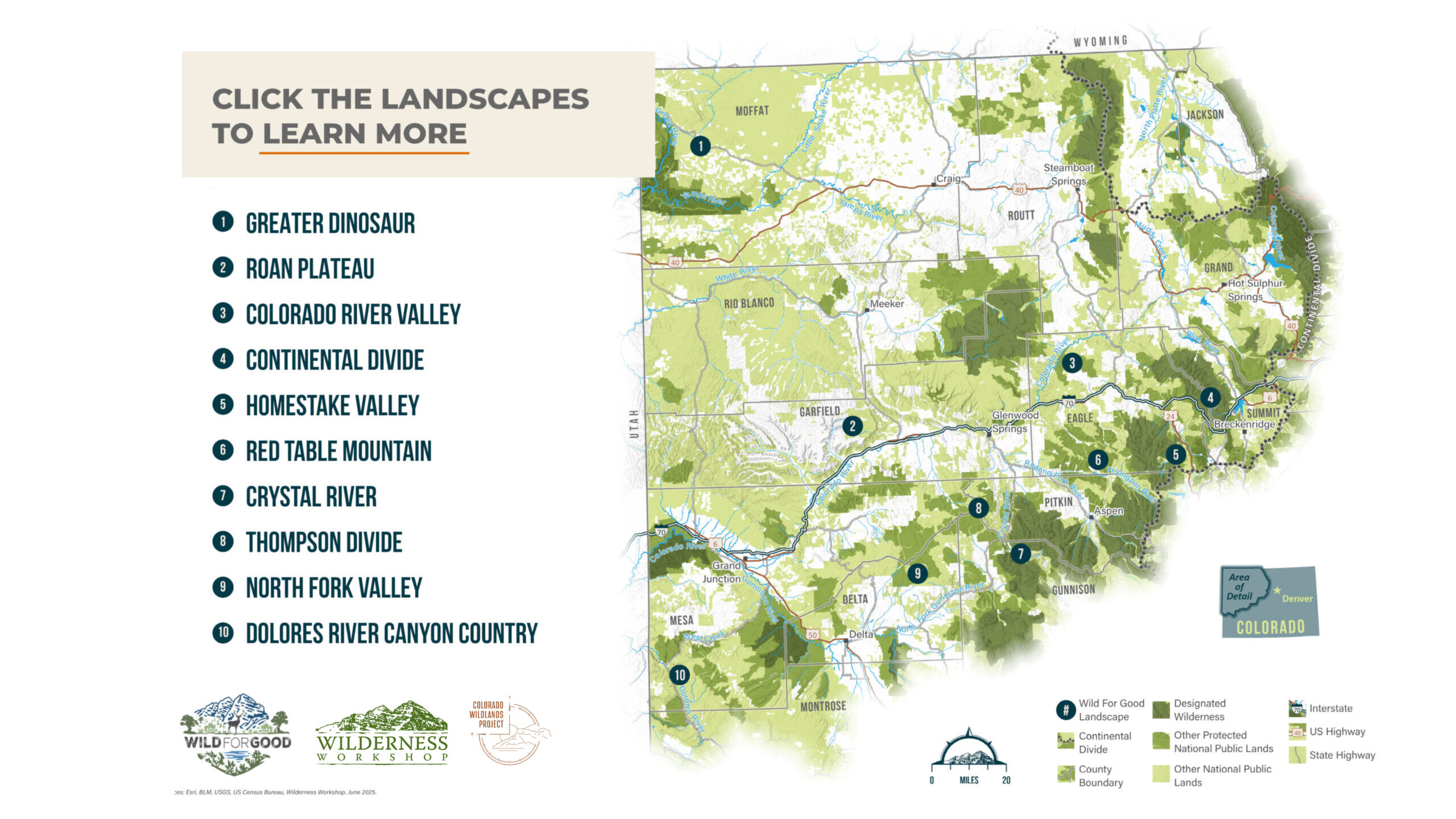
Explore the Wild For Good Landscapes

Protect what you love. Act today.
Proactive work to protect our local public lands is more important than ever. Please join us in this important work. Together, our community can keep our treasured public lands and waters…Wild for Good.
_square")